

Accelerate Your Land & Row Data Transformation
Our team pairs AI-driven extraction with SME review to convert agreements into verified, geo-referenced polygons — built once, usable everywhere across land, GIS, and ROW systems.
Your Land Department is Drowning in Paper. Your AI Strategy is Waiting on the Other Side of It.
Boxes of agreements. PDFs no one can query. Records that haven't been touched since the 1970s. Every project, deal, and compliance deadline runs through this pile — and it slows everything down.
- check_circle Manual research consuming hours your best people don't have
- check_circle Permitting and capital projects delayed waiting on right-of-way data
- check_circle M&A integration stalled by unstructured, unverified legacy records
- check_circle Renewals, obligations, and payments slipping through the cracks
- check_circle AI and analytics initiatives blocked by data that isn't structured, mapped, or clean
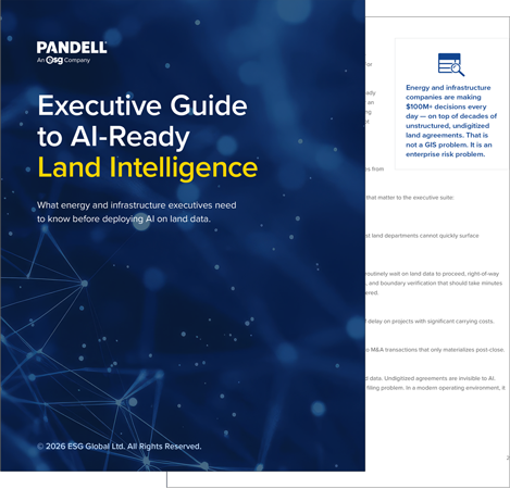
Download the Executive Guide to AI-Ready Land Intelligence
Understand what your land data gaps are really costing you — and what modern operators are doing about it.

“If you do not know what you own, there are no checks and balances to verify you’re getting paid what you’re owed.”
— Siting & Land Rights Manager, Major U.S. Utility


The Only End-To-End Pipeline From Agreement to Polygon
No one else does this. AI-driven extraction, SME-verified QA, document-to-polygon automation at industrial scale — delivered directly into LandWorks and your GIS. Cheaper, faster, and more accurate than building it yourself.
Flexible commercial models to fit how you work: declining-balance services or scoped SOWs. Whether you're processing hundreds of agreements or hundreds of thousands, we scale to match.
Request a DemoTurn Paperwork Into Performance
AI-automated, SME-verified, and mapped to your assets — so every team that touches land data moves faster, takes less risk, and makes better calls.
Kill the Paper Bottleneck
Stop wading through boxes and PDFs. Find any agreement, obligation, or expiry in seconds — indexed, searchable, and queryable in LandWorks or your Land Management System of choice
Eliminate Compliance Risk
Renewals, encumbrances, and payment obligations surfaced automatically. No more missed deadlines, stranded revenue, or audit exposure hiding in a filing cabinet.
From Clause to Coordinate
We're the only service that takes agreements all the way to geospatial polygons at scale — georeferenced, WhiteStar enriched, and delivered into your GIS.
Faster M&A Integration
Day-one readiness on acquisitions. Ingest, digitize, validate, and integrate large volumes of acquired land records before the ink dries — not months after close.
Unlock Your AI Strategy — Finally
Machine learning can't reason about land rights, boundaries, or obligations until the data is structured, georeferenced, and validated. Paper to Poly™ builds the foundation.
Trusted by Industry Leaders Across North America

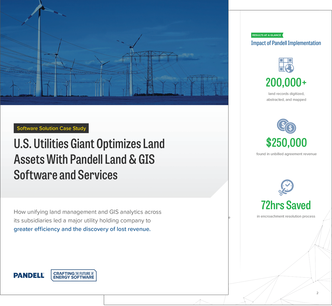
U.S. Utilities Giant Optimizes Land Assets With Pandell
A major utility holding company managing 200,000+ land records across eight U.S. states consolidated its disparate systems with Pandell — and in doing so, discovered a 1976 parking-lot agreement, one of thousands never billed. Four decades of fees were collected in full.
Download the Case Study
Learn how unifying land management and GIS analytics across its subsidiaries led a major utility holding company to greater efficiency and the discovery of lost revenue.

What Leading Energy Companies Say
“Pandell gave us a trusted data foundation going into our acquisition. What used to take months of manual work was done in weeks — and we had confidence the data was right.”
VP of Land
Grid Scale Renewables Company
“We cut data preparation time by over 50% after digitizing our legacy land files with Pandell. Our land team can find what they need instantly — and our operations teams are no longer waiting on land research to move forward.”
Director of Land
Enterprise Midstream Company
“Pandell’s assessment alone surfaced data gaps we didn’t know we had. It changed how we think about land data as a strategic asset, not just a filing system.”
CIO
Major Electric Utility Company
Land Data Problems Don’t Stay In the Land Department
Land Teams
- check_circleStop losing hours to manual research. Find any lease, obligation, or expiry in seconds, not days.
- check_circleManage land contracts from a single, trusted source.
- check_circleKnow your obligations before they become missed deadlines.
Operations & Engineering
- check_circleNo more delays waiting on right-of-way confirmations that should take minutes.
- check_circleGive field teams the agreements and map data they need from anywhere, on any device.
- check_circleAlign land and operations from day one of every project.
A&D Teams
- check_circleStructured, validated land data means due diligence in days, not weeks.
- check_circleCatch boundary gaps and rights conflicts before close — not after.
- check_circleWalk into every acquisition knowing exactly what you're buying.
Executives & Finance
- check_circleMake asset decisions with a complete, current view of your land position — not a best guess.
- check_circleThe gap between operators who can deploy AI on their land data and those who can't starts here.
- check_circleLand data that is digitized, validated, and maintained is an asset. Unstructured records are a liability.
FAQ

Get Your Land Risk Score in a Single Engagement
Not sure what your land data gaps are costing you? A Land Intelligence Assessment gives you answers — fast, with no long-term commitment required.
Request a Demonstration
Thank you for taking the first step in considering Pandell for your company.