
Pandell Projects is designed for:
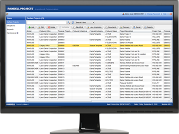
Escape the tedious task of compiling and sending project file updates via email. Pandell Projects enables energy operators and their land services partners to track, communicate, and report land acquisition project details in real-time over the web.
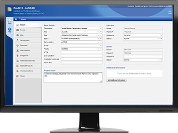
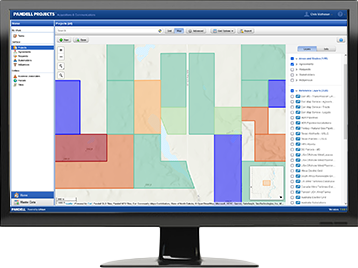
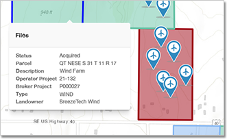
View agreement and project data on interactive maps that are color coded to their project acquisition status. View an entire project, or drill down to specific areas, parcels, and other related criteria.
Ensure every user sees what project tasks are assigned to them. Administrators can configure roles and teams, then create automated task models and rules to manage workflow for any type of project task assignments, status changes, and email updates.


Projects integrates directly with our new web-based consent portal, Pandell Connect. Submit requests, communicate with stakeholders, and exchange consent documents, all from within Projects.
Optimize Your Land Asset Management
Elevate your land management with streamlined workflows and precise location intelligence
Cloud-based Project Hub
A collaborative working environment and single source of truth where energy operators and their land service partners with secure access can record, manage, and map project information.
Central Repository
Features a central data repository to hold all project-related agreement details in one place. Gives the entire project team access to live information, anytime.
GIS Mapping Integration
Using embedded GIS mapping tools, users can visualize layers of geographical and environmental data along with their project data on interactive digital maps.
Mobile Device Friendly
Modern web-based technology including a new mobile app ensures staff in the field can view project information from any device, even when they’re offline.
Document Generation
Select any project file or segment of land and automatically generate user-specific documents such as Surface Leases, Right-of-Way Agreements, and Notification Letters.
Workflow Wizards
Multiple workflow wizards provide step by step guidance through key processes to ensure all required steps are validated and complete.
Dynamic Search
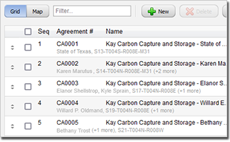
An advanced grid search engine displays any combination of variables tracked in the system. Filter projects by any field or drag and drop agreements to reorder and export the results.
System Integration
Projects integrates with Pandell LandWorks and Pandell Connect for end-to-end digital data and document management that minimizes errors and improves data integrity.
Stakeholder Tracking
Record, manage, and report consultation work with landowners and community stakeholders, including indigenous, environmental, and regulatory authorities.
Timesheet Audit Trail
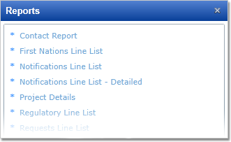
Predefined & Ad hoc Reports
Identifies Project Bottlenecks
Saves & Shares All Documents
Record & Upload Info From the Field
Seamless Version Upgrades
Communication Tracking
Mineral & Surface Lease Acquisitions
Critical Obligations Workflow
Full rent reviews
Project Performance Reporting
Historical Data Tracking
Upload Survey Plans & Agreements
Maps Acquisition Data
Freehold Acquisitions
Tracks First Nations Consultations
Tracks Occupant Consultations
Tracks Landowner Consultations
First Nations Letters
Right-of-Way Agreements
Notification Letters
ROC Logs (First Nations)
Third Party Agreements
Proximity Requests

Download the Pandell Projects Brochure PDF.

Download the Record of Consultation Log Brochure PDF.