Industry Knowledge
Work with highly trained Pandell specialists


Energy Services
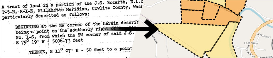
When in-house GIS expertise is limited, other priorities need attention, or automated mapping fails, our team meticulously analyzes land data and legal descriptions to create polygons that represent the boundaries of agreements on a map.
This provides a centralized visual reference for agreement details, such as ownership, obligations, and restrictions, enabling better analysis, land use assessment, and regulatory compliance.

Work with highly trained Pandell specialists
Access the knowledge and experience of our full services team
Work with experts who are fluent in land management software
Get personalized service with one main point of contact
Temporary, short term, or long term coverage depending on your needs
Save on employee overhead: recruiting, training, salary, benefits, equipment, etc
Before, mapping land rights was a time-intensive and manual effort. Since TEP started working with Pandell’s GIS Mapping Services in 2016, our right-of-way agents are more equipped to respond quickly and plan more effectively.
We’re making smarter, safer decisions across our grid as we scale up to meet growing customer demand.
Patrick Dubberly, Environmental & Land Use Planner III (GIS), Tucson Electric Power